Komarakshi Fm
Type Locality and Naming
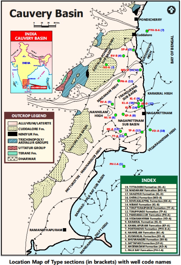
SUBSURFACE: The type section is located at exploratory well Komarakshi-A (depth interval: 3315-2390 m), in the Tranquebar subbasin. The hypostratotype is in the well PY-C-B (depth interval: 3465-2935 m). It was named after the Komarakshi village by ONGC team directed by Venkatarengan et al., (1993) and distributed as Document-VII by KDMIPE, ONGC, Dehradun (1993).
[Figure 1: Type-section Map of Subsurface Formations]
Lithology and Thickness
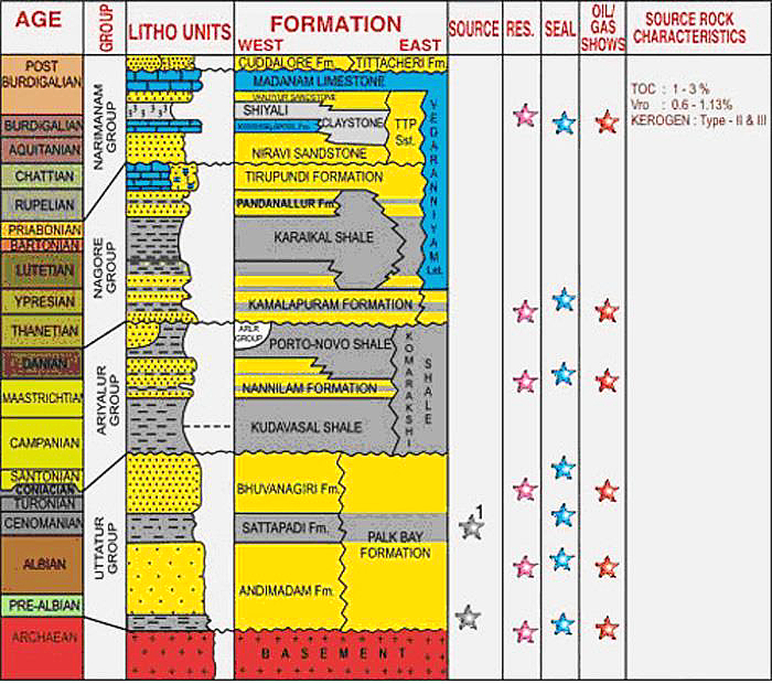
Claystone. Predominantly calcareous silty shale. It is gray to greenish gray, hard, compact, fissile with calcareous silty bands, abundant biotite and spots of glauconite, with calcite/aragonite along bedding planes. Its thickness varies from 530-925 m. Part of Ariyalur Gr.
[Figure 2: Generalized Stratigraphy and Petroleum System of Cauvery Basin (from dghindia.gov.in)]
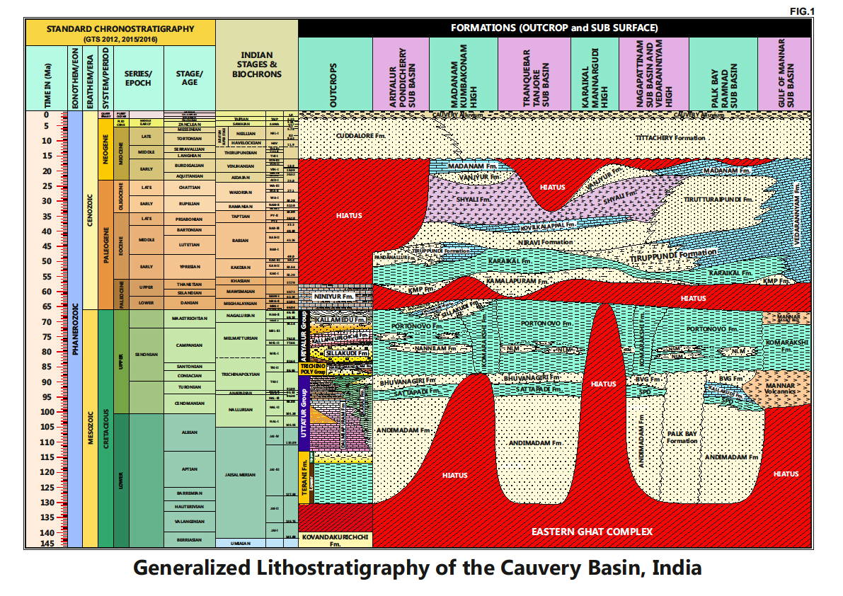
[Figure 3: Generalized Stratigraphy of Cauvery Basin (Provided by A. Nallapa Reddy & R. Nagendra)]
Relationships and Distribution
Lower contact
Unconformable with the Bhuvanagiri Fm / Palkbay Fm.
Upper contact
Unconformable with the Kamalapuram Fm /Karaikal Fm.
Regional extent
Mainly present in the eastern part of the basin, (i) west of Madanam area, (ii) the Nagapattinam subbasin and parts of Palkbay, and (iii) Mannar subbasin.
GeoJSON
Fossils
Planktonic foraminifera- Abathomphalus mayaroensis, Globotruncanita stuarti, Gt. stuartiformis, Globotruncana ventricosa, G. arca, G. rugosa, G. fornicate, G. rosetta, Rugoglobigerina rugosa, R. rotundata, Heterohelix striata; and Benthic foraminifera- Dorothia sp., Gavelinella monterelensis, G. stelligera and robust arenaceous taxa.
Age
Depositional setting
Outer neritic-Upper bathyal.
Additional Information
It is equivalent (biostratigraphic) to the exposed Garudamangalam Fm, Sillakkudi Fm, Kallankurichchi Fm, Ottakovil Fm and Kallamedu Fm in the outcrops.


